Mynd:Medieval Arab Palestine.jpg
Stærð þessarar forskoðunar: 464 × 599 mynddílar Aðrar upplausnir: 186 × 240 mynddílar | 372 × 480 mynddílar | 824 × 1.064 mynddílar.
Upphafleg skrá (824 × 1.064 mynddílar, skráarstærð: 191 KB, MIME-gerð: image/jpeg)
Lýsing
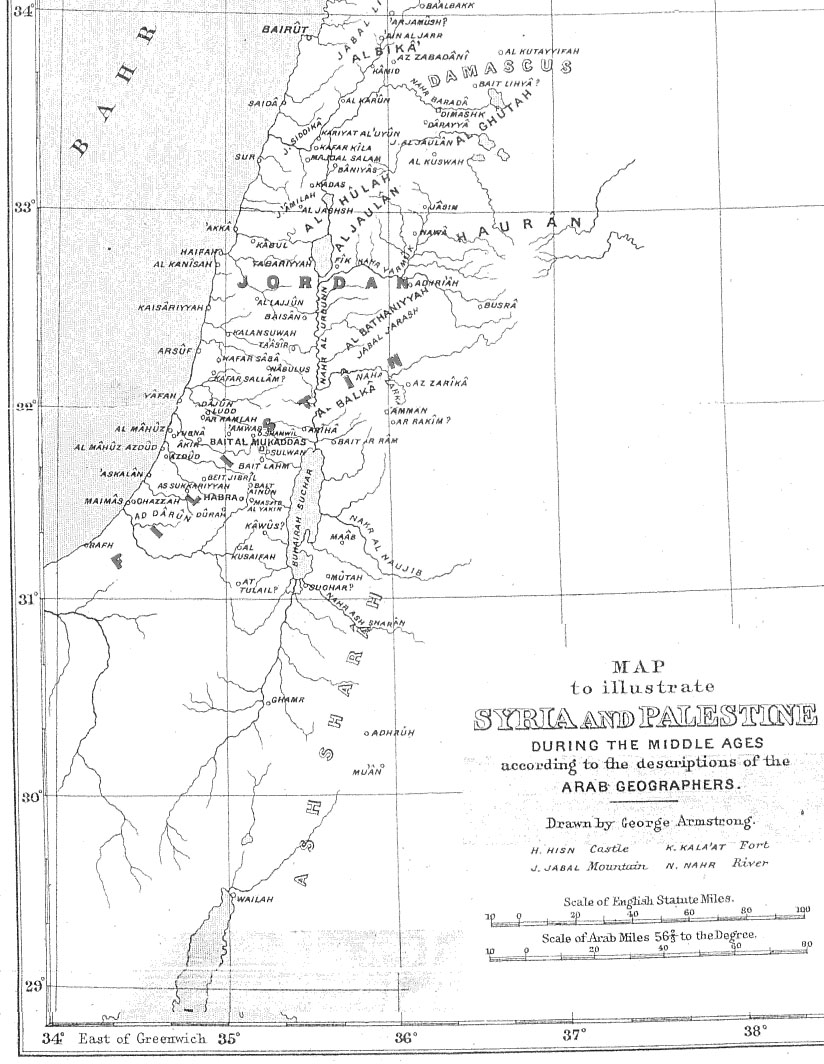
| Lýsing | Map of Palestine during the Middle Ages according to the description of the Arab geographers, drawn by Geo. Armstrong, from Palestine Under the Muslims: A Description of Syria and the Holy Land from AD 650 to 1500, by Guy Le Strange, London 1890 |
| Dagsetning | 16. nóvember 2004 (original upload date) |
| Uppruni | Transferred from en.wikipedia to Commons. |
| Höfundarréttarhafi |
The original uploader was Mustafaa at enska Wikipedia. Later versions were uploaded by AnonMoos at en.wikipedia. |
Leyfisupplýsingar:
|
This work is in the public domain in its country of origin and other countries and areas where the copyright term is the author's life plus 70 years or fewer. This work is in the public domain in the United States because it was published (or registered with the U.S. Copyright Office) before January 1, 1929. | |
| This file has been identified as being free of known restrictions under copyright law, including all related and neighboring rights. | |
Original upload log
The original description page was here. All following user names refer to en.wikipedia.
- 2005-09-21 17:41 AnonMoos 824×1064×8 (195077 bytes) Losslessly cropped image to area of interest
- 2004-11-16 21:36 Mustafaa 979×1072×8 (218293 bytes) Map of Palestine during the Middle Ages according to the description of the Arab geographers, drawn by Geo. Armstrong, from ''Palestine Under the Muslims: A Description of Syria and the Holy Land from AD 650 to 1500'', by Guy Le Strange, London 1890 (henc
Breytingaskrá skjals
Smelltu á dagsetningu eða tímasetningu til að sjá hvernig hún leit þá út.
| Dagsetning/Tími | Smámynd | Víddir | Notandi | Athugasemd | |
|---|---|---|---|---|---|
| núverandi | 21. júní 2007 kl. 19:37 | 824 × 1.064 (191 KB) | Friðrik Bragi Dýrfjörð | {{Information |Description=Map of Palestine during the Middle Ages according to the description of the Arab geographers, drawn by Geo. Armstrong, from ''Palestine Under the Muslims: A Description of Syria and the Holy Land from AD 650 to 1500'', by Guy Le |
Skráartenglar
Eftirfarandi síða notar þessa skrá:
Altæk notkun skráar
Eftirfarandi wikar nota einnig þessa skrá:
- Notkun á ar.wikipedia.org
- Notkun á azb.wikipedia.org
- Notkun á da.wikipedia.org
- Notkun á en.wikipedia.org
- Notkun á es.wikipedia.org
- Notkun á fy.wikipedia.org
- Notkun á ilo.wikipedia.org
- Notkun á lt.wikipedia.org
- Notkun á nl.wikipedia.org
- Notkun á nn.wikipedia.org
- Notkun á no.wikipedia.org
- Notkun á pnb.wikipedia.org
- Notkun á ps.wikipedia.org
- Notkun á ro.wikipedia.org
- Notkun á si.wikipedia.org
- Notkun á sk.wikipedia.org
- Notkun á ur.wikipedia.org
- Notkun á uz.wikipedia.org
- Notkun á zh.wikipedia.org